Geotechlab The site of the Geotechnical Lab

Image Analysis for Geotechnics

A wide variety of digital image processing techniques has recently spread in the geotechnical field. These techniques are used for different purposes: surface reconstruction, monitoring, extraction of the displacement field in 2D and 3D conditions.

In these years we also worked in this field developing some methodologies and codes.

Reconstruction of the 2D displacement field

A digital correlation technique (White and Take, 2002) was used to measure the 2d strain field during the loading test of a plate on the top of a sandy slope . Their results were used for comparison with strain field obtained with numerical DEM simulations .

Vertical displacement field from (a) laboratory measures (with the PIV technique) and (b) simulated with the Discrete Element Method .

Landslide Displacement Detector

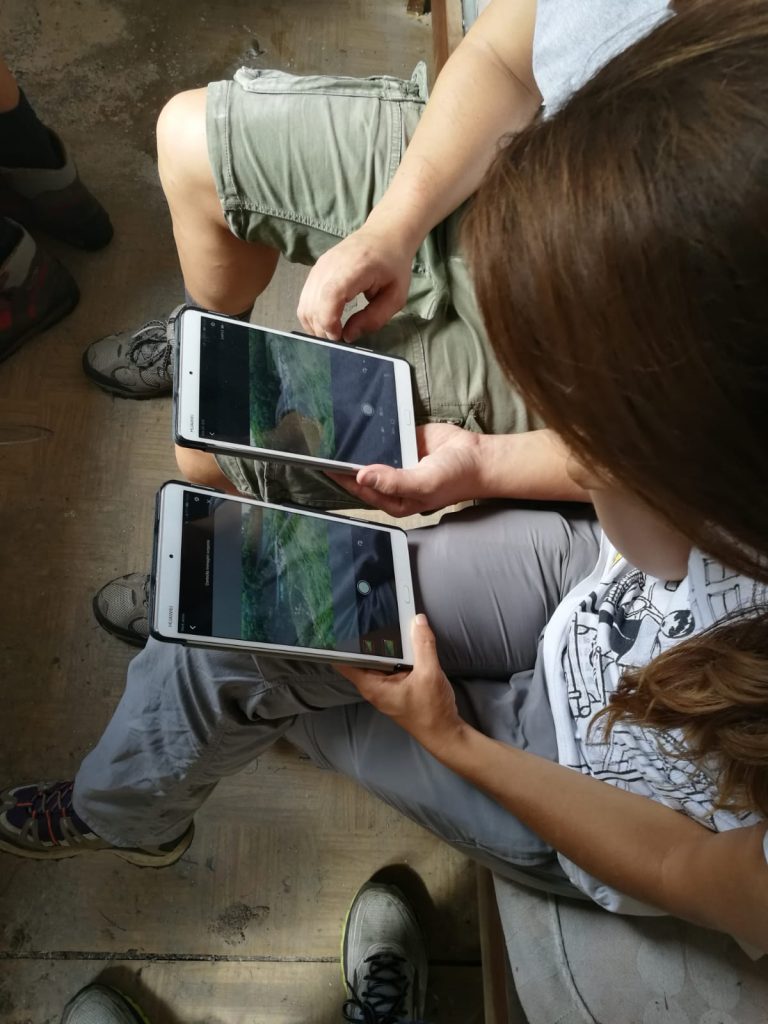
In 2011 we developed a Matlab tool called “Landslide Displacement Detector” for monitoring landslides and tracking the motion of objects and surfaces along slopes. This code uses different implementations of some widely known digital image correlation algorithms (SAD, SSD, NCC) and is able to work with sequence of images. The Tessina landslide site was one of the first monitoring sites we used for testing this method. The upper detachment area of the landslide body was monitored with two cameras inserted in waterproof boxes, fixed on two pillars and remotely controlled.

Source area of the Tessina landslide and the position of the monitoring station.
Example of daily snapshots of the source area from 2013/04/17 to 2013/05/02.

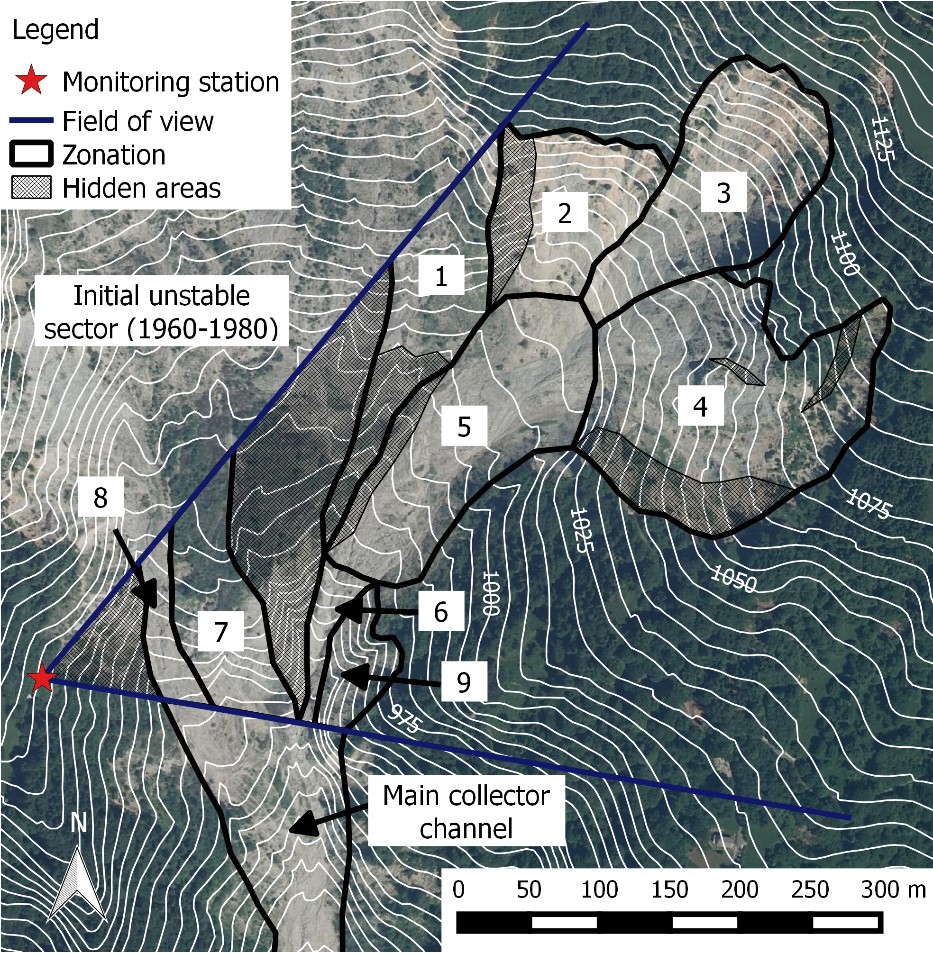
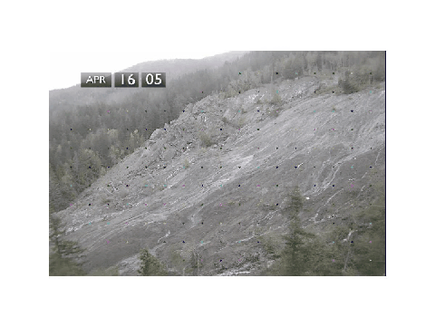
The analysis of the long-lasting sequence of images (almost 3 years of observation), allowed to obtain information on the dynamics and the evolution of the landslide and on the impulsive behaviour of different areas .

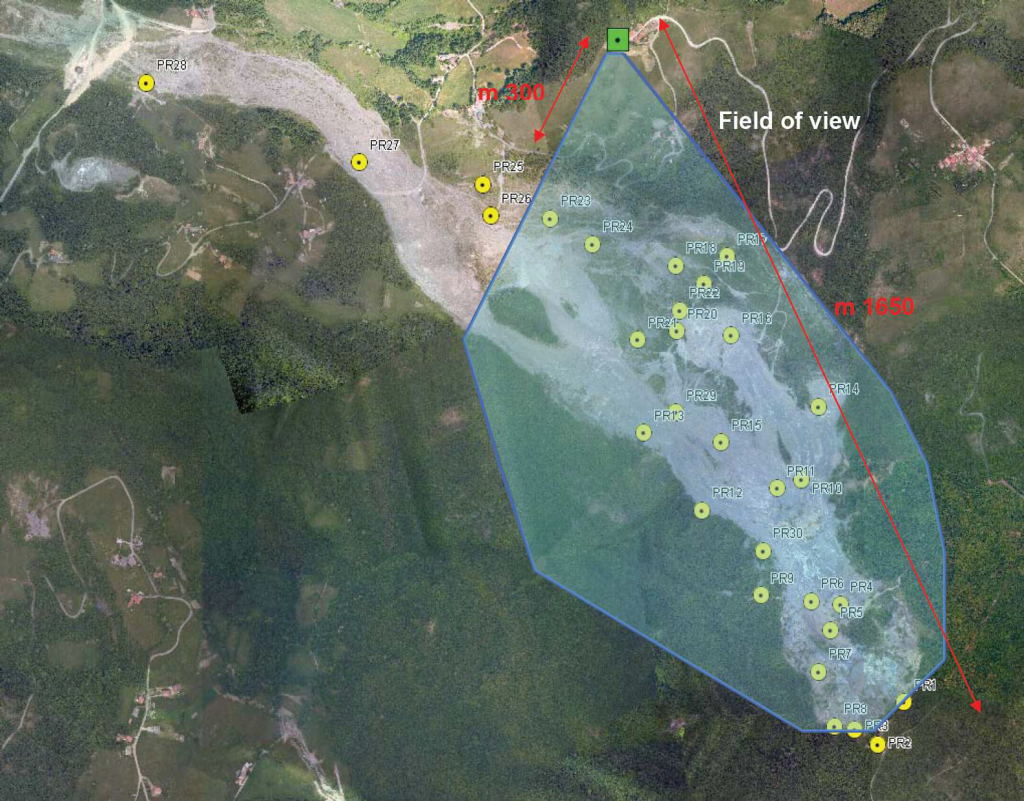
Other data on this monitoring campaign can be obtained on this site: https://horatius.irpi.pd.cnr.it/tessina/

The same technique was used for the monitoring of the Valoria landslide site in the Appennino .

Aerial view of the monitored area at the Valoria landslide site .
Click on the image to see Landslide Displacement Detector in action.

Reconstruction of the 3D displacement field

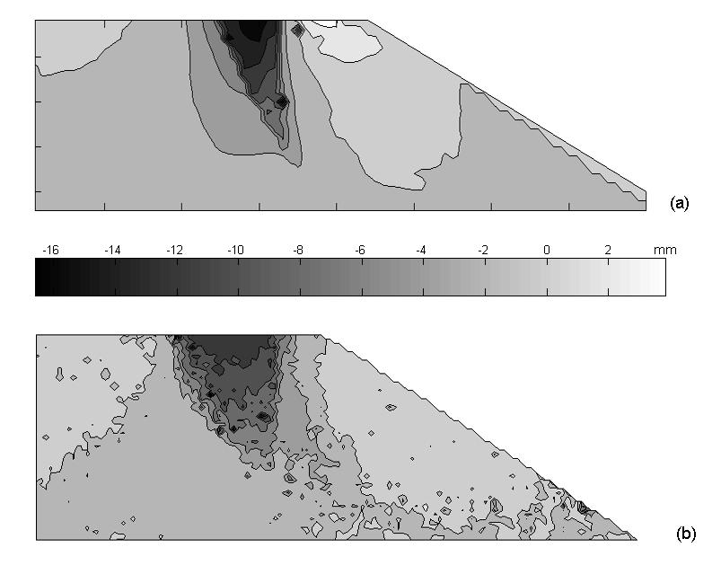
During the same period, we tested the capability of a multiple-cameras system in extracting the information about 3d surfaces and 3d movements.

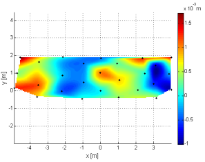
The first experiments were conducted on a wall instrumented with optical targets that were moved with sub-millimetre accuracy. These tests permitted to estimate the precision and accuracy of this method .

Contour plot of the errors in z-displacement measurements.

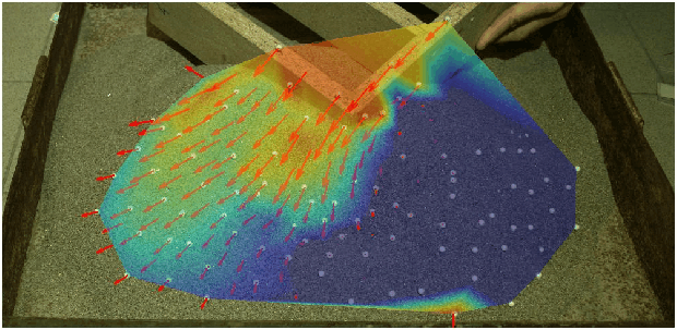
After these tests, we moved to simple 3D laboratory tests moving regular objects (plastic balls) and natural surfaces (sand piles).

3D reconstruction of the displacement field of a granular pile during shearing. the strain field was obtained with two convergent cameras (Gabrieli, Antonello, Tosetto).

Then we used this method for the 3d displacement monitoring of a real earth work .

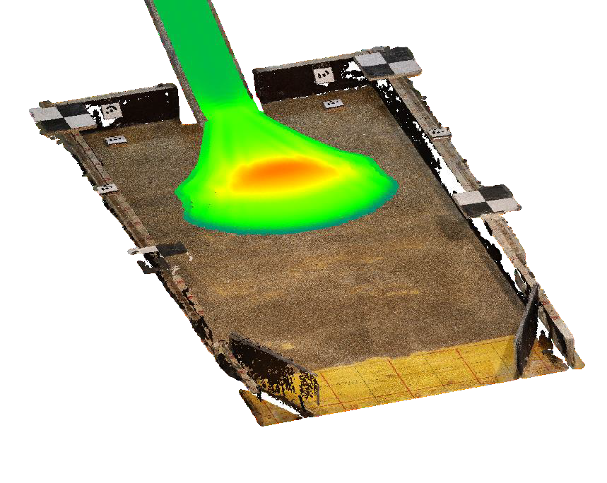
The method was also used for 3d reconstruction of the shape of deposits in laboratory collapse tests .
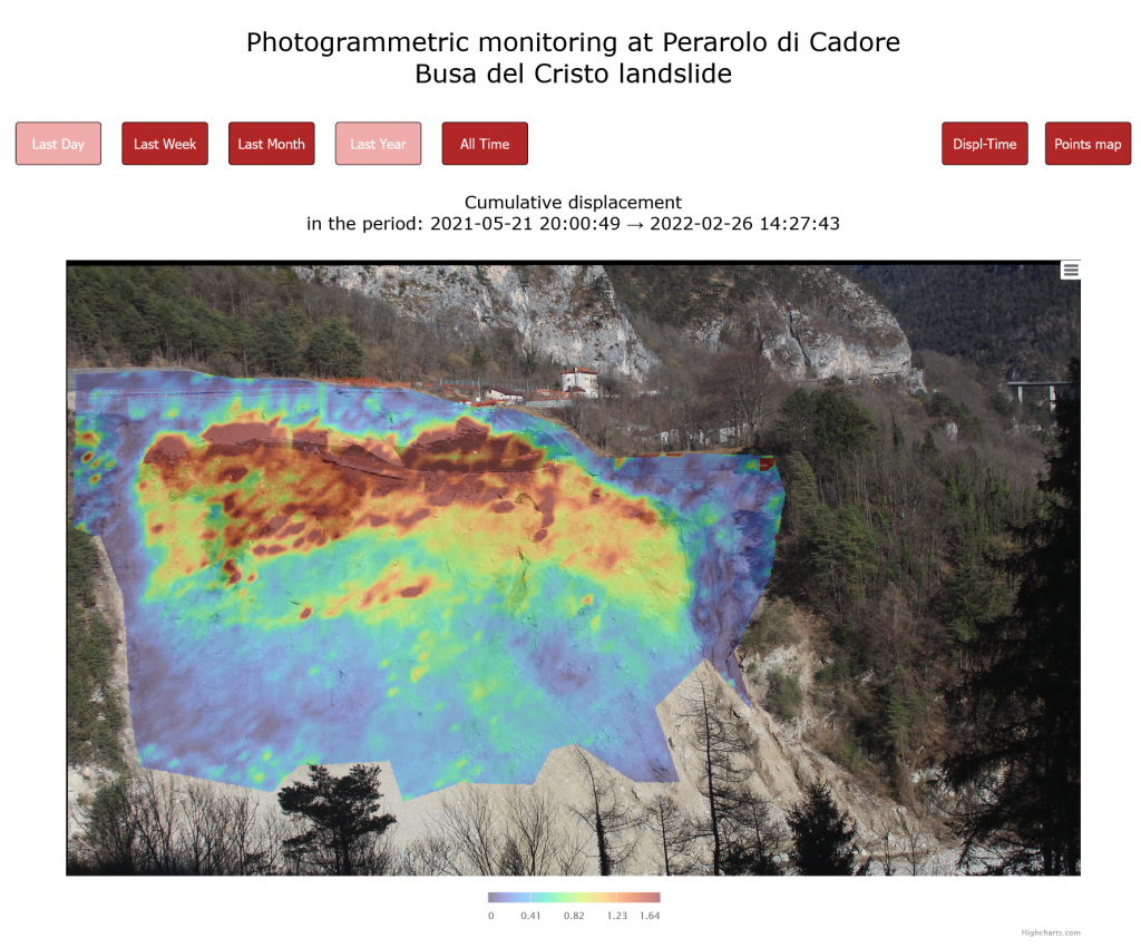
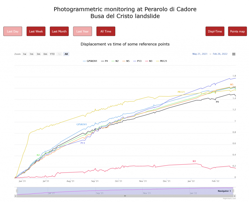
Example of 3d reconstruction of a deposit in a laboratory collapse test with a mud of kaolin, water and sand .

An finally it was recently extended to time lapse images of landslides .

3D displacement field of the source area of the Tessina landslide.
3D displacement field obtained from a sequence of photos of the Fantoni landslide (Brezzi, Gabrieli).
3d reconstruction of the Mt. Peron (Santa Giustina, BL)

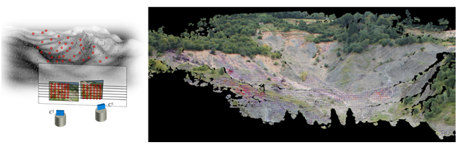
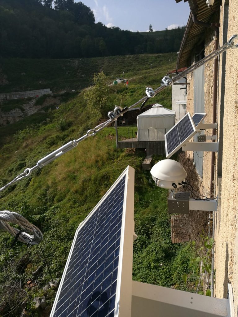
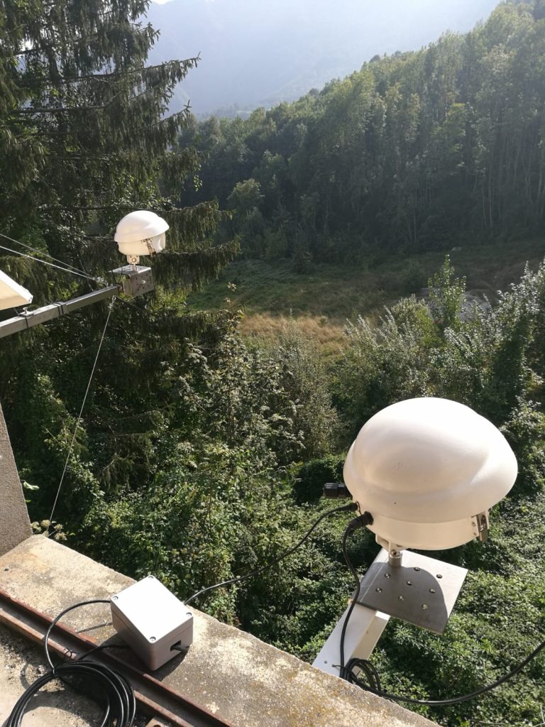
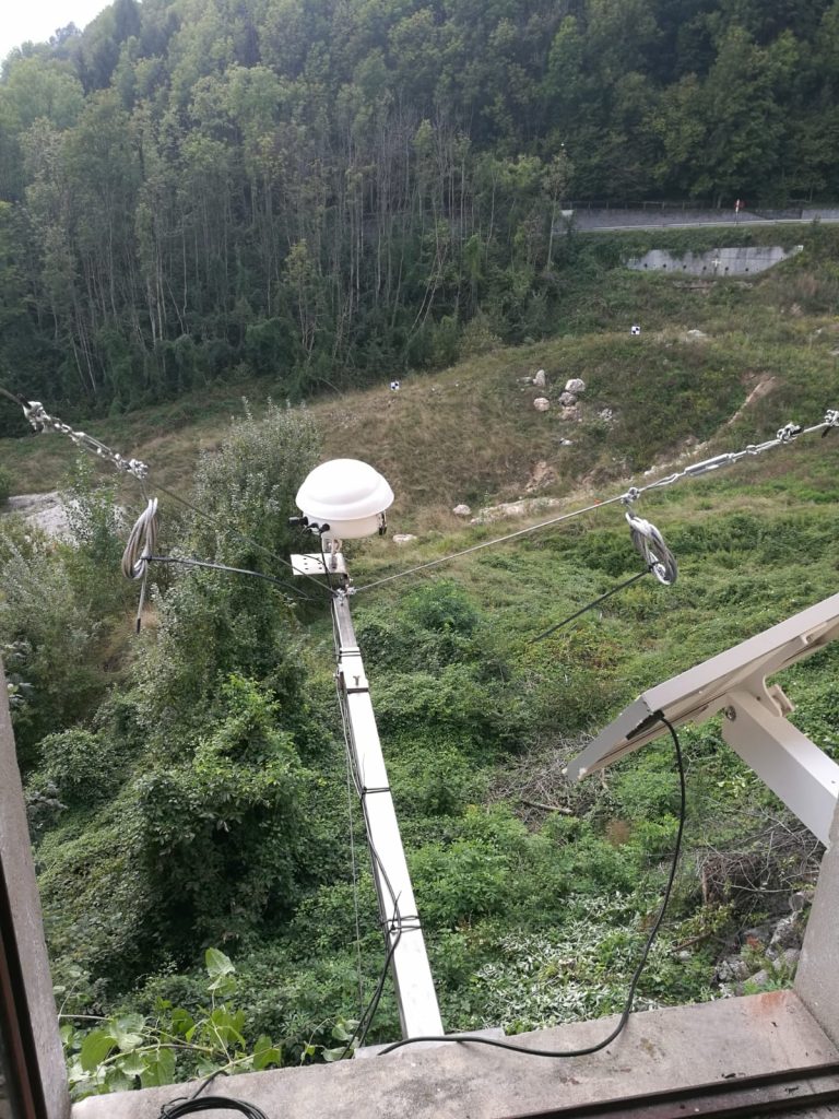
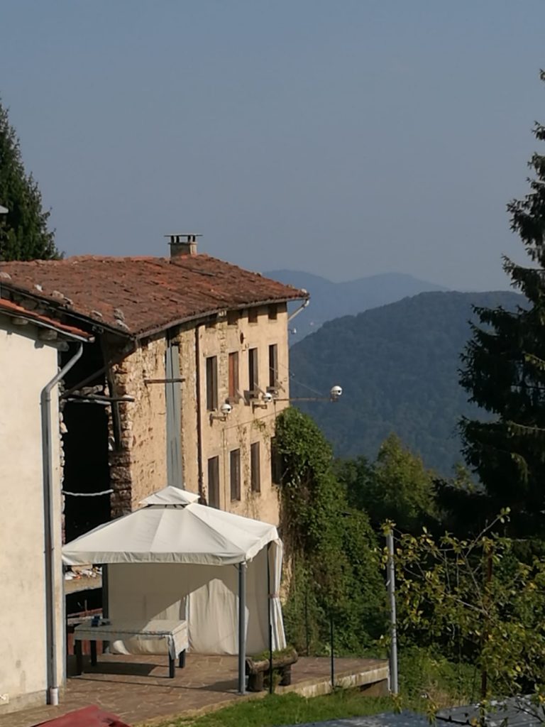
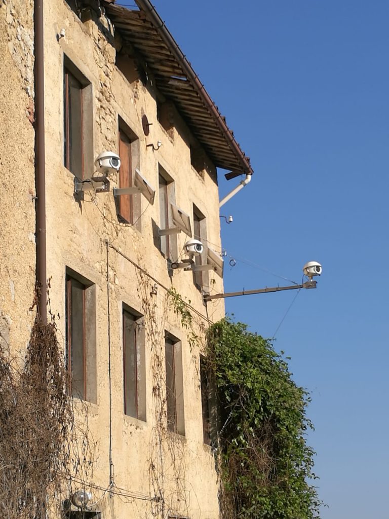
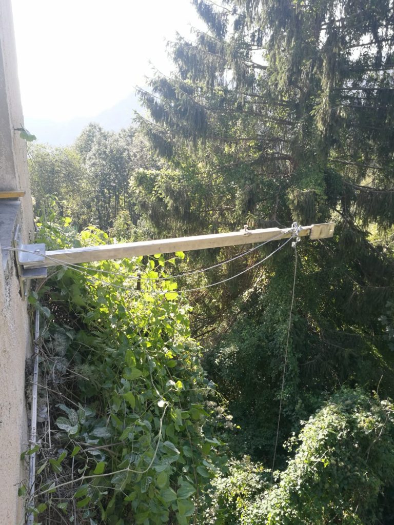
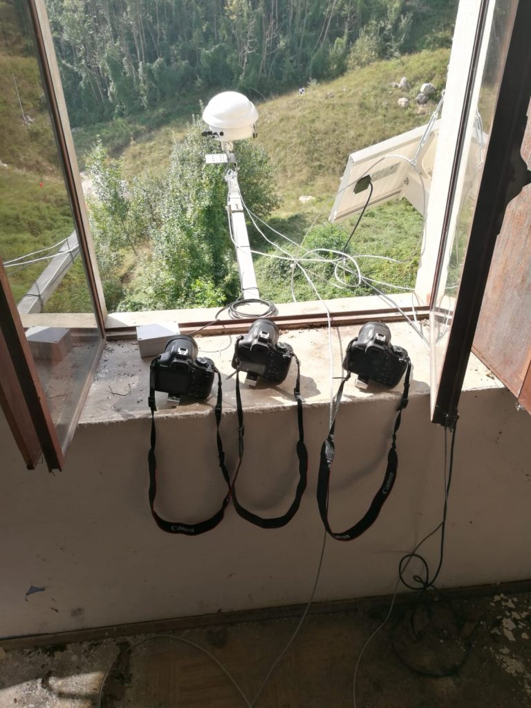
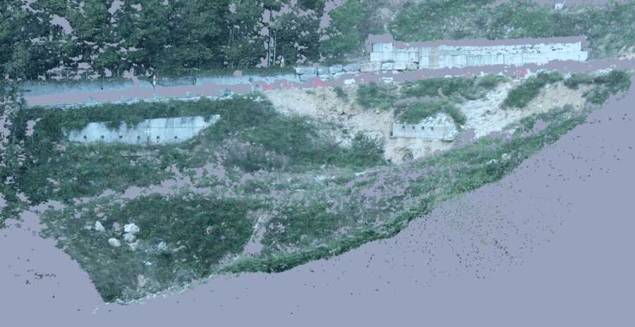
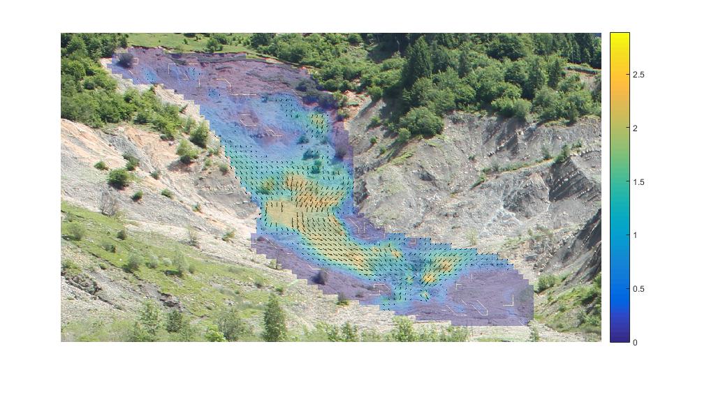
The 3D displacement survey method has been successfully applied to the Perarolo di Cadore landslide. At this link it is possible to consult the daily monitoring of the landslide through photogrammetry. Below are some results.

3d total displacement map obtained with the photogrammetric method
3d Displacement rate obtained from photos of some reference point

References

Gabrieli, F., & Cola, S. (2008). Particle Image Velocimetry to measure displacements of a model sandy slope. Proceeding 11th Interpraevent Congress 2008, Extended Abstract, Extended A, 114–115.
Gabrieli, F., Cola, S., & Calvetti, F. (2009). Use of an up-scaled DEM model for analysing the behaviour of a shallow foundation on a model slope. Geomechanics and Geoengineering, 4(2), 109–122. https://doi.org/10.1080/17486020902855688
Gabrieli, F., Cola, S., & Carraro, S. (2011). Messa a punto di un sistema fotogrammetrico per il monitoraggio di pareti di scavo. Innovazione Tecnologica Nell’Ingegneria Geotecnica, 2, 465–470.
Antonello, M., Gabrieli, F., Cola, S., & Menegatti, E. (2013). Automated landslide monitoring through a low-cost stereo vision system. CEUR Workshop Proceedings, 1107, 37–41.
Motta, M., Gabrieli, F., Corsini, A., Manzi, V., Ronchetti, F., & Cola, S. (2013). Landslide displacement monitoring from multi-temporal terrestrial digital images: Case of the valoria landslide site. Landslide Science and Practice: Early Warning, Instrumentation and Monitoring, 2, 73–78. https://doi.org/10.1007/978-3-642-31445-2_9
Cola, S., Gabrieli, F., Marcato, G., Pasuto, A., & Simonini, P. (2016). Evolutionary behaviour of the Tessina landslide. Rivista Italiana Di Geotecnica, 50(1).
Brezzi, L., Gabrieli, F., Kaitna, R., & Cola, S. (2016). Behaviour of mudflows realized in a laboratory apparatus and relative numerical calibration. Geophysical Research Abstracts, 18.
Gabrieli, F., Corain, L., & Vettore, L. (2016). A low-cost landslide displacement activity assessment from time-lapse photogrammetry and rainfall data: Application to the Tessina landslide site. Geomorphology, 269, 56–74. https://doi.org/10.1016/j.geomorph.2016.06.030
Top